2nd annual Mt. Mangatarem Tree for Juan (3-4-1)organized by TUCO, KABAN and Hunyango.
 We were always warmly welcomed by the locals of Barangay Pacalat, Mangatarem Pangasinan. They love us and greatly appreciate our return for another Outreach, Tree planting - but unfortunately, No Medical Mission this time. We were welcomed by Kap to his Mango filled backyard, allowed to eat its bounties and let-in his home, all 40+ of our group.
This years climb is more chill than the initial, due to some turn of events that required less of our time doing trailworks and more time naturally bitching about the trail difficulty.
Almost a year has passed since I remember hardly making it to the summit, left packs at the fork- and with just an empty gatorade container, catching breathe, struggling knees, phanting.. almost giving up. This time, that same grounds- will be our camp for the night.

Getting there.
315AM-740AM - Leave Pasay on Bolinao bus. - Arrived at Mangatarem Pangasinan.
740AM-820AM - Buy supplies at nearby market, Eat breakfast.
830AM-900AM - Multicab ride to Barangay Pacalat.
1140AM-12:10PM - From Kaps house to Dam-River Crossing.
1210PM-1240PM - Arrived at Patag, just across the Hanging Bridge. Take 5.
1245PM-140PM - Arrived at sole water source. Re-fill, Rest, Lunch.
320PM-420PM - Arrived at fork. Take 5.
445PM-530PM - To Summit Camp site.
A repeat always makes things less difficult. In our return, the area was easier to map in mind.
Compromised Bridge = Dam River Crossing.
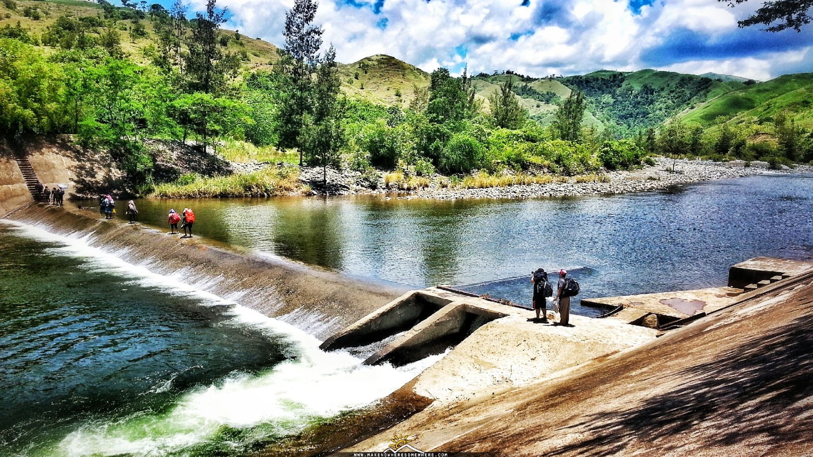 |
| Peaceful waters at Pacalat Dam. |


Seeing Kap last year walk against the high speed river gush under the dam, makes everyone dread of our own safety. Reason why we had to let the nights rain fall waters pass, and wait from 9AM to almost 12noon to resume. What should have been a 10minute cross to the hanging bridge makes for an hour, as we had to back trail after crossing the Dam.
Take 5 then push.
 |
| Patag Camp Site. |


 |
| Tirikan Trail. |
After what I'd like to call, Patag camp site, just across the bridge- the trail here ascends but gradually until one reaches the fully exposed and slightly steeper Tirikan trail. Under the noon sun, walking under this trail can truly put one to overheat and just stop. This is not a good idea though as it subjects the body further compromised. As a consolation, turn around -the view here is nice. Gather your energy as a water source under the Alibangbang tree is at the area near the fork.
Ah- water.


Here after, is almost entirely a sun exposed trail but if you planned it the way we took it, the sun would have been more forgiving by then. Rocky areas, tall blade grasses, gradual ascends, red soil, just some things to expect before nearing the next stop.
Fork.
 |
| Further the horizon is the Fork. |
Pseudo summits.


Camp Site.


We were told that locals still hunt wild animals here -probably an hour away around higher grounds. Given that, I assume they have traps laid out on animal trails.


 |
| Nursery down the pseudo summits marks as resting area after the 40minute descend. |
Last year, the more difficult part of the hike was going down the fork to the river camp site. It was a 2hour steep descend which we took while day light's fading. Then initial trail after the nights rest from the river is to river cross.
Due to the groups consensus -and adding a 2hour descend to fulfill the traverse and another 2 or 3 hours to make it back at kaps- although it should be fun and exhilarating crossing rivers, we decided to backtrail.
800AM Depart -1100AM Arrival


Rock sands.


150PM-230PM
Outreach.


Still having difficulties gauging knee handicap even with patela support. At decision trail, contributed to backtrail vote rather than the more adventurous river crossing. May be wise that I've done so.
Water discipline and cardio endurance improved compared to last year. Must maintain ideal BMI and regular 10minute continuous jogs.


